When Cyclone Fengal roared ashore on the evening of 30 November 2024, the India Meteorological Department (IMD) had already issued red alerts for Tamil Nadu, Andhra Pradesh, Kerala and Karnataka. The Puducherry Government shut every school in the Union Territory, and the Meenambakkam Airport in Chennai grounded all flights until the next morning. By 11:30 IST on 1 December, the system had weakened to a deep depression just 30 km north of Cuddalore. The whole episode unfolded over a frantic five‑day stretch that left more than a dozen districts drenched and a region on high alert.
Cyclone Fengal’s Evolution and Peak Strength
Back on the early hours of 30 November, the IMD recorded three‑minute sustained winds of 85 km/h, classifying Fengal as a cyclonic storm. The U.S. Joint Typhoon Warning Center (JTWC) saw even stronger one‑minute gusts at 95 km/h and a central pressure of 987 hPa. Those numbers meant the cyclone was moving west‑northwest at about 13 km/h, hugging the southwest Bay of Bengal at latitude 12.3° N and longitude 80.9° E. "The storm was picking up speed just enough to punch through the coastal barrier," noted senior meteorologist Arun Prasad of the IMD.
From a satellite viewpoint, Fengal’s eye was never fully defined, but its cloud‑top temperatures dropped sharply, a classic sign of intensification. By the time it neared the coast, gusts were flirting with the 90 km/h mark – enough to snap thin branches and fling unsecured objects across lawns.
Landfall Impacts on Puducherry and Tamil Nadu Coastline
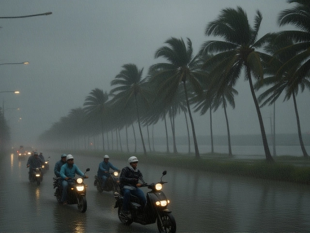
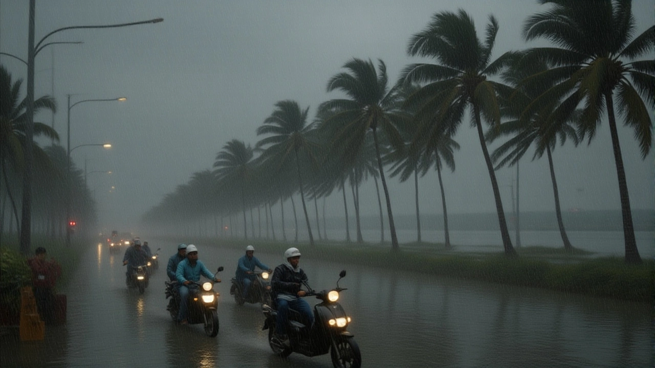
The storm made landfall between the Karaikal and Mahabalipuram stretches, right over the Puducherry‑Marakkanam corridor. Wind speeds at landfall were estimated at 70‑90 km/h, with the strongest gusts recorded in the Tiruvallur to Mayiladuthurai districts. Coastal towns like Karaikal saw roofs ripped off lightweight shanties, while Mahabalipuram’s historic shoreline monuments bore the brunt of sand‑laden blasts.
Rainfall was another beast altogether. While the IMD warned of heavy showers across the entire southern peninsula, the Tamil Nadu System for Multi‑hazard Potential Impact Assessment, Alert, Emergency Response Planning and Tracking (TNSMART) logged a maximum of 137 mm in Kotagiri on 19 October 2024 – a reminder that the region had already endured an unusually wet pre‑monsoon season. On the day of Fengal, Chennai registered 68 mm of rain within three hours, flooding the Gemini Flyover and turning Mount Road into a shallow river.
Government and Agency Response
From the top down, authorities moved fast. The IMD’s red alert triggered pre‑emptive evacuations of over 12,000 fishermen who were ordered to pull their boats ashore and park them on higher ground. The Puducherry Government not only closed schools but also set up temporary shelters in community halls across the union territory.
In Tamil Nadu, the state disaster management authority dispatched 150 rescue teams, each equipped with inflatable boats and portable generators. "Our priority is to keep people safe and ensure that essential services like electricity and water are restored within 24 hours," said Dr. Kavitha Ramesh, chief of the Tamil Nadu Disaster Relief Cell.
Security forces patrolled the beaches of Puducherry, deterring looters and helping stranded tourists find transport. Meanwhile, the airport’s suspension of flights was a pre‑emptive measure to avoid aircraft damage; flights resumed at 06:00 IST on 1 December, albeit with a trimmed schedule.

On‑the‑Ground Effects in Chennai and Surrounding Districts
Chennai’s streets turned into obstacle courses. Residents of New Washermanpet described ankle‑deep water that forced them to wade home with flashlights. Two‑wheelers stalled on the Gemini Flyover, and traffic snarls stretched for kilometers. Power outages affected roughly 45,000 households, though most were back online within six hours thanks to quick repairs by the Tamil Nadu Electricity Board.
In the interior districts, the heavy rain triggered landslides near the Nilgiris. Villagers in Kovilankulam (Virudhunagar) reported 135.4 mm of rain in a single day, prompting local officials to issue a separate warning for flash floods. "We’ve never seen the soil turn to mud so fast," recalled farmer S. Murugan of Coimbatore district.
Forecast Outlook and Historical Context
After the coastward punch, Fengal turned northeast, weakening steadily into a deep depression by the afternoon of 1 December, then to a simple depression later that evening. The remnant low drifted across northern Tamil Nadu, emerged over coastal Karnataka on 3 December, and dissolved into the Arabian Sea by 4 December.
While the storm was relatively modest compared with the super‑cyclones of the past, it reminded everyone of the region’s vulnerability. The 1999 Odisha super‑cyclone, Cyclone Phailin (2013), Hudhud (2014), Titli (2018) and Dana (2024) have all underscored how quickly a low‑pressure system can turn deadly.
Climate analysts note that the Bay of Bengal’s sea‑surface temperatures were a full 1.2 °C above the seasonal average, a factor that likely nudged Fengal’s intensity upward. "Warmer waters act like extra fuel for these systems," explained Dr. Rita Singh, a climatologist at the Indian Institute of Tropical Meteorology.

What’s Next for the Remnant System?
Even as the cyclone’s core dissipated, the IMD warned that the lingering low could spawn scattered thunderstorms across the interior plateau for the next 72 hours. Agricultural fields, already water‑logged, risked further damage from hail or strong gusts. Residents are urged to stay tuned to official bulletins and heed any new advisories.
In the bigger picture, authorities are already reviewing evacuation protocols, especially for fishing communities that lost livelihoods overnight. The hope is that lessons learned from Fengal will sharpen response times for future storms that may approach from the Bay of Bengal.
Frequently Asked Questions
How did Cyclone Fengal affect daily life in Chennai?
Heavy rain flooded major thoroughfares like Gemini Flyover and Mount Road, causing traffic jams, power outages for about 45,000 homes, and forcing commuters to wade through ankle‑deep water. Schools remained closed until 2 December, and many shops reported loss of inventory due to water damage.
What measures did the Puducherry Government take before landfall?
The government issued a red alert, shut all schools in the Union Territory, ordered fishermen to secure or relocate vessels, and opened emergency shelters in community halls. Security forces were deployed along the coastline to maintain order and assist tourists.
Why did the India Meteorological Department classify Fengal as a cyclonic storm?
IMD’s classification is based on sustained wind speeds. Fengal’s three‑minute sustained winds hit 85 km/h, placing it within the 62‑88 km/h range that defines a cyclonic storm in the Indian meteorological scale.
What are the expected weather conditions for the next few days?
The lingering low‑pressure system may generate scattered thunderstorms across interior Tamil Nadu and parts of Karnataka for the next 72 hours. Residents should stay alert for sudden downpours, gusty winds up to 40 km/h, and possible localized flooding.
How does Fengal compare to previous cyclones in the region?
Fengal was milder than historic super‑cyclones like the 1999 Odisha event, but its rapid intensification and the extent of waterlogging it caused are reminiscent of Cyclone Phailin (2013) and Cyclone Hudhud (2014), underscoring the Bay of Bengal’s capacity for sudden, disruptive storms.